My earliest memories of orienteering are when I was in 2nd year of secondary school at VOLA and I got on the outdoor activity week that was running out of the Strathclyde Regional Council Outdoor Centre at Arrochar. I also remember stalking the training area up around Fort George with a few other officer cadets during my brief and inglorious Army service. We did OK and this was a return to the origins of foot orienteering as a map reading exercise as part of army training.
In Midlothian and Edinburgh, we are very fortunate to have a large number of permanent orienteering courses (POCs) that have been established by ESOC and Interlopers clubs and I’ve made use of the maps they publish since moving back to Scotland in 2007.
My work as an outdoor leader has gradually reintroduced me to orienteering. At first I was using orienteering courses in the Pentlands and at Glenmore Lodge as a form of solo navigation training for my attempt at my Summer ML and later success at HML. Using the techniques and opportunities offered by orienteering started in earnest during my Mountain Training expedition skills module when I was first introduced to the approaches that Nigel Williams was developing that have now become the core of the National Navigation Award Scheme (NNAS) methods of teaching navigation skills. I had the opportunity to learn from Nigel when I did the NNAS Tutor Award up at Glenmore Lodge a few years ago.
NNAS has really stimulated my interest in orienteering again as a means of navigation training. Going back to basics helped me distinguish between the map and compass skills I had used as a geologist and palaeontologist for many years, which were often about location (or relocation as I now understand it to be) and putting data points on maps. As I’d worked with maps and compasses for many years before starting ML training, I thought I would be OK but my training and assessment showed this not to be the case. I’ve been doing Mountain Training courses or working towards and taking assessments for almost nine years now and it is only in the past four that I’ve unpicked navigation and grasped the difference between the overall discipline and the subset of skills that I routinely use in scientific fieldwork. Probably the most helpful pointer about navigation skills came as a line from Davy Virdee of Mountain Active during an Aspen Outdoors CPD day.
‘Navigation is about the things that are close to you.’
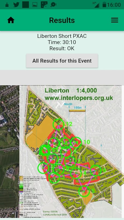
Among one of my many tasks at present is investigating Map Run and MapRunF tools for smartphone orienteering while I am working from home. By good fortune, I’ve got two great POC courses within easy walking distance of the Hills of Hame base and also found that Interlopers have a MapRunF supported course right in my neighbourhood. So Shadow the dog and I downloaded the event, printed off the map and took to the streets for a slightly more purposeful walk than usual. Having virtual controls means no surfaces to touch and we kept our 2 m distance as per guidance.

Results page for Interlopers Liberton Short course. PXAC code means it is a linear course. Red line gives track taken.
To explain a bit more about the area I live in, it is a mixture of two types of ex-council housing. Part of the area is pedestrianized and has narrow ‘lanes’, which gives some rather interesting challenges on the controls, in the same way that a control that needs to be accessed by going round a forestry block from a major track to get along a ride to ‘get in the circle’.
Shadow’s map-reading skills were questionable but he is the Hills of Hame mascot.


Leave a comment